Scattered showers and thunderstorms are on tap this afternoon....thus, this will be a pretty brief update. A Severe Thunderstorm Watch remains in effect for a large portion of the region today:
With any storms that develop this afternoon/evening, the primary threat will be large hail/damaging wind gusts.
After today's action, our next round is still on tap for Friday & Saturday. Models are still in very good agreement on a cold front passing through the region, bringing a good chance of widespread showers and storms.
By 7PM Friday night, the front will be bisecting the region...probably leading to some wet weather for Friday night football. Here's a snapshot of what the forecast models are showing:
GFS 6-hr precip at 1AM Saturday:
European model 6-hr precip at 1AM Saturday:
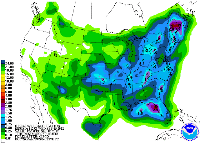
Should be a decent rainfall event, with latest HPC forecast showing around 1" for most of the region:
Models were flip-flopping over the past couple of days with whether or not this system would move on through or hang up to our east as a closed low....but today it seems they have come into agreement on a more progressive solution that pushes this system to our east by Sunday. This will bring a dry end to the weekend, and some very pleasant temperatures as well.
(A little R &R time on the way for TO, so the blog will return Tue 9/11.)


No comments:
Post a Comment