Above is a snapshot from the NAM model at 7AM Tuesday, showing an elongated trough sprawling from the Great Lakes all the way toward the Gulf Coast....leading to continued unsettled weather.
The 7AM Tuesday surface chart depicts a surface low along the KY/TN border to our east....with clouds and some drizzle/spotty showers continuing across the area through most of the day. Rainfall totals on Tuesday should generally remain below 0.25", and temperatures will again struggle to even reach the mid 60's.
This system will continue to spin over the region through Wednesday morning, and today's model runs actually keep a small chance of light rain in the forecast through early Wed...especially in S. IL & SEMO.
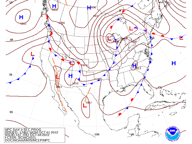
By Thursday, another pretty strong cold front will be positioned off to our west (shown above). There have been some timing differences over the last couple of days in the models as far as when the front will enter and exit the region, so there could be some changes to the forecast over the next few days as models come into better agreement. As of now, it looks like Friday should be when the front brings some rain....as shown below by the GFS (6 hr precip through 7PM Friday)
 This front looks like it will bring a healthy batch of cool air to the region for the weekend. Right now, it looks like highs in the 60's and lows in the lower 40's will be likely....maybe cooler?
Speaking of cooler, the October monthly outlook from the Climate Prediction Center is out and calls for a good chance of below average temperatures and average precipitation for our part of the country.
Temperature Outlook:
Precipitation Outlook:


